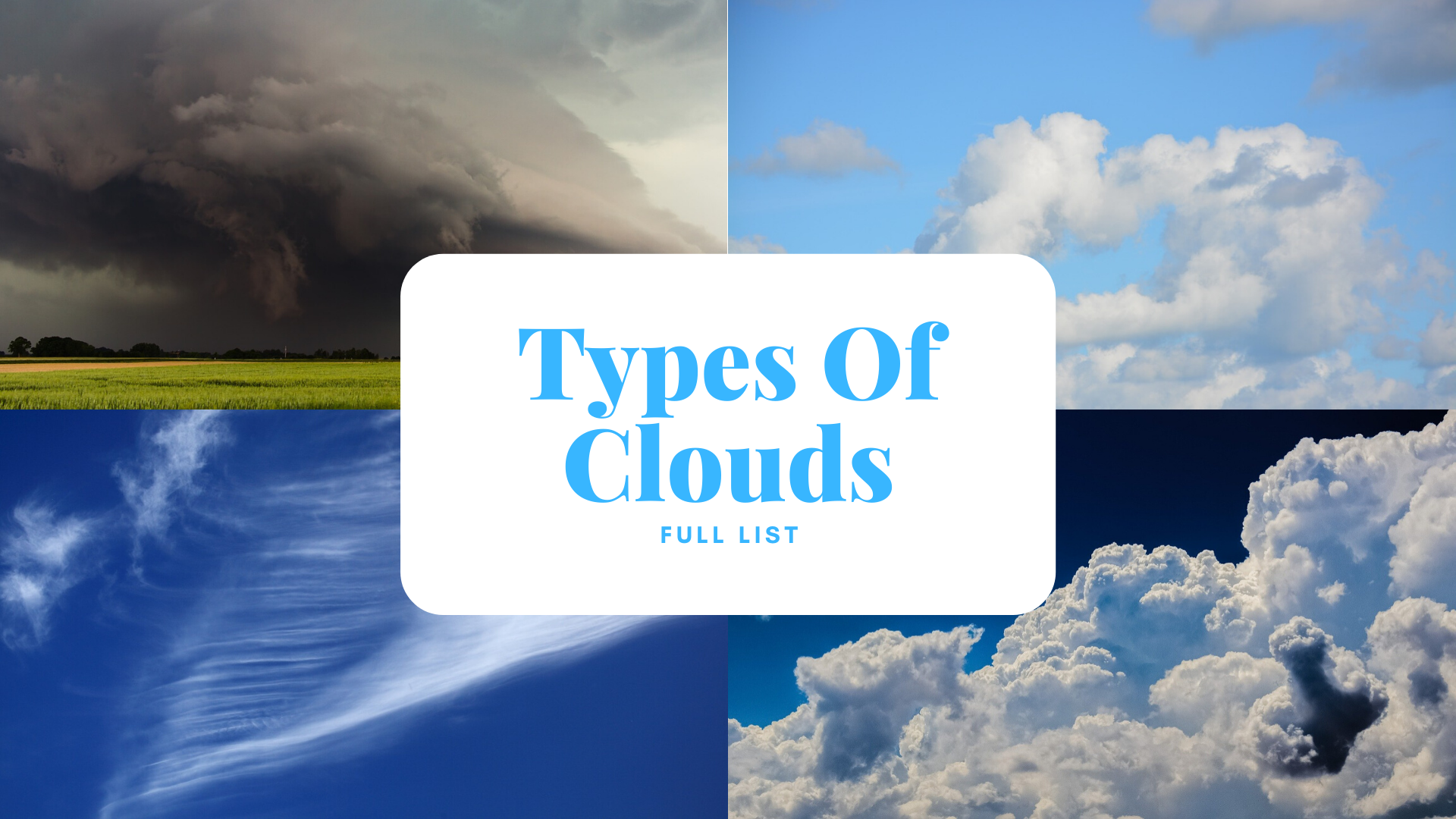
The types of clouds in the sky include the stratus, cumulus, stratocumulus, altocumulus, altostratus, cirrus, cirrostratus, cirrocumulus, cirrostratus, nimbostratus, and cumulonimbus. These 10 types of clouds are then characterized into the different altitudes in which they typically are found.
Clouds are formed by the accumulation of water vapor in the air, and they bring moisture to the various regions of the globe. Have you ever wondered what the various kinds of clouds are, and what kind of weather they appear in?
“The clouds — the only birds that never sleep.” — Victor Hugo
There are actually over 100 different kinds of clouds, but for the sake of simplicity, most of them can be grouped into ten different categories. These ten categories of clouds include low-level clouds, middle-level clouds, high-level clouds, and cumulonimbus clouds (which move across the various levels of the atmosphere).

Photo: Bess-Hamiti via Pixabay, CC0
Low-Level Clouds:
- Stratus
- Stratocumulus
- Cumulus
Starting with the clouds found closest to the ground, low-level clouds include stratus clouds, cumulus clouds, and stratocumulus clouds. These are the clouds which form beneath 6600 ft, or two kilometers, from the ground and are made out of droplets of water.
Stratus clouds don’t really have definable features. Instead, they appear as a flat, uniform layer of gray clouds that hang low over the horizon. They can resemble fog and can easily envelop cities located at higher altitudes. They are normally associated with fine, misting rain or a slight drizzle.
“Clouds come floating into my life, no longer to carry rain or usher storm, but to add color to my sunset sky.” — Rabindranath Tagore
Cumulus clouds are the white, puffy clouds that show up on nice, mostly sunny days. If there’s a symbol for clouds, these are probably them. The top of the clouds are puffy, but the base of the clouds tend to be flat, and they form at about 1000m off the ground. Sunny days heat the ground right below the clouds, causing them to appear. They usually appear on days when rain isn’t very likely, and thus they are sometimes referred to as “fair weather” cumulus.

Photo: By Nicholas A. Tonelli from Pennsylvania, USA – Drive-Through, CC BY 2.0, https://commons.wikimedia.org/w/index.php?curid=21218979
Stratocumulus clouds are those which appear at low altitudes, spread out over the sky as a thin layer, and have small gaps of sky in between them. They can be grey or white and have a patchy, honeycomb-like appearance to them. These clouds form on mostly cloudy days with low convection and they may bring light drizzle with them.
Middle-Level Clouds:
- Altostratus
- Altocumulus
Middle-level clouds are those which form between 2 kilometers to 7 kilometers (6500 feet to 23000 feet) into the sky. They may be composed out of either ice crystals or water droplets. The exact physical composition of the clouds will depend upon the temperature and altitude of the clouds. Middle-level clouds are altocumulus clouds and altostratus clouds.
Altocumulus clouds are clouds that have one half that is darker than the other. They are usually rounded and they tend to form in groups. They are typically around one kilometer thick, which you can test by holding your thumb at arm’s length. If the clouds are about as wide as your thumb, they are probably altocumulus clouds. Altocumulus clouds are the most common middle-level clouds, and they may herald a thunderstorm later in the day if they appear on humid mornings. Altocumulus clouds and stratocumulus clouds are frequently confused with one another, but in addition to being about as wide as your thumb at arm’s length, they are also much higher in the sky.
Altostratus clouds are also mid-level clouds, but they aren’t as common as altocumulus clouds. They usually have a bluish-gray tinge to them, and if they appear they are probably visible across the entire sky. The sun or moon will be hazy through altostratus clouds, and their presence may indicate snow or rain later in the day. They usually manifest ahead of occluded or warm fronts, but can also be found alongside cumulus clouds when there is a cold front.
High-Level Clouds:
- Cirrus
- Cirrostratus
- Cirrocumulus
High-level clouds are those which form from approximately 5 kilometers to 12 kilometers in the sky (16,500 to 40,000 ft up). Temperatures at this elevation are cold and the water molecules freeze as a result, meaning that clouds at this level are usually composed of supercooled water droplets or crystals of ice. High-level clouds are cirrus clouds, cirrocumulus clouds, and cirrostratus clouds.

Photo: Strecosa via Pixabay
Cirrus clouds are long, wispy and curled. The tiny ice crystals that make up the clouds are found above 6000 meters (20,000 feet) and are often referred to as mare’s tails. Cirrus clouds usually show up in fair weather, yet they can also manifest in front of heavy weather like tropical cyclones since they are frequently driven by warm fronts.
“How sweet to be a cloud, floating in the blue.” — A. A. Milne
Cirrocumulus clouds are those clouds which show up as long rows of small puffy white clouds. They’re notable because they look a little like the scales of a fish and can be spread across much of the sky. They show up during times of high convection are typically rather short-lived, dispersing quickly. This makes them fairly rare. They can form with frontal systems inbound, so they may indicate precipitation in about half a day.

Photo: CC BY-SA 3.0, https://commons.wikimedia.org/w/index.php?curid=246913
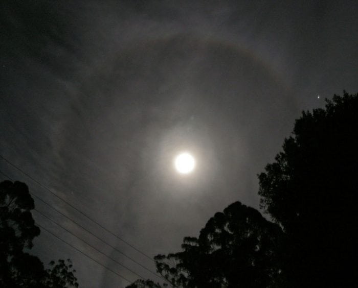
Cirrostratus clouds are very thin clouds which form in long sheets that cover the entire sky. Thanks to the fact that the clouds are so thin, when the sun shines through them it tends to get a halo effect, due to the way the clouds bend the light. Cirrostratus clouds may signal rain in 12 to 24 hours, and they are indicative that a warm front may be approaching the area.
Multi-Level Clouds:
- Cumulonimbus
- Nimbostratus
Multi-Level clouds are the clouds that span across different levels of the sky. Multi-level clouds are cumulonimbus clouds and nimbostratus clouds.

Photo: GregMontani via Pixabay
Nimbostratus clouds are those which form above 2 kilometers (6600 feet) into the sky, but as they grow heavy with moisture they thicken and drop into the lower level of the cloud layers. Nimbostratus clouds are the clouds most people think of as rain clouds, and they comprise a thick, dark gray layer that covers the sky. They bring large amounts of rain and snow to widespread areas.
Cumulonimbus clouds are clouds that can stretch across the low, middle and high cloud levels. Cumulonimbus clouds look like massively inflated cumulus clouds, with puffy edges. They rise into towering cloud structures that have high tops shaped like cauliflower plumes or anvils. The bottom portions of the clouds are usually hazy and dark, due to being laden with so much moisture. Cumulonimbus clouds bring almost exclusively thunderstorms and can come with severe weather like hail and tornadoes.
The many different kinds of clouds bring various kinds of weather with them. Of course, just seeing a type of cloud isn’t a guarantee that the associated type of weather will happen, but being aware of the different kinds of clouds could enable you to make some guesses about what kind of weather will happen in your area.


