


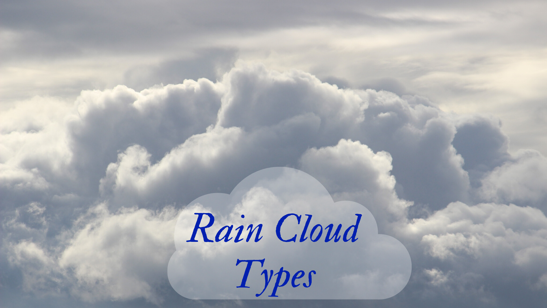
There are many types of rain clouds, including the three most common types: stratus, cirrus, and cumulus. From there, you can get variations of rain clouds like stratocumulus, nimbostratus, and cirrostratus and more.
Close are arguably the most commonly observed weather event. People watch clouds to get an idea of whether or not it will rain during their morning hike or afternoon picnic. Yet there are many different types of rain clouds. What kinds of clouds bring rain? Furthermore, how do these clouds form? Let’s take a detailed look at the various formations of rain clouds and the various types of clouds you should be on the lookout for if you’re curious about the possibility of rain.
The Classification of Clouds
Before talking about the various kinds of clouds it would be helpful to lay the groundwork and discuss how clouds are classified. The different terms that meteorologists use to classify clouds are based upon a combination of the appearance of the clouds and the altitude of the clouds. Clouds that are found at low levels include cumulus clouds, stratocumulus clouds, and stratus clouds. Mid-level clouds are similar to the stratus and cumulus clouds but they have the “alto” prefix in front of them, making them altocumulus or altostratus clouds. The clouds which are found at the highest altitudes are typically wispy looking and have the “cirro” prefix in front of them making them cirrocumulus, cirrus, and cirrostratus clouds.
How Do Clouds Form?
All clouds, despite their various shapes and sizes, are made out of condensed water or ice. Clouds are created when warm air expands and rises. As the air rises higher and higher, it begins to cool, which makes the water molecules, or water vapor form clumps more quickly than the thermal energy of the water vapor tears them apart from one another. The water vapor condenses together and forms ice crystals or cloud droplets. Convection is the name for this process and convective clouds are created from warm columns of air.
“Heavy hearts, like heavy clouds in the sky, are best relieved by the letting of a little water.” — Christopher Morley
After the droplets or ice crystals are formed and a cloud is created, they can either grow or shrink. If the droplets shrink as the air heats up they will evaporate and turn back into water vapor, but if they continue to join one another and grow then they will eventually become heavy enough to fall out of the sky as precipitation – rain or snow. Approximately half of the clouds will turn into precipitation systems, and the other half will evaporate again.
What Are Nimbus Clouds?
“Nimbus” comes from a Latin term translating to “rainstorm”. Nimbus clouds are those which bring precipitation, and they usually appear in the sky as dark gray. The gray color comes from the fact that they are dense and deep, which prevents much of the sun’s light from filtering through them. Nimbus clouds can also bring rain, snow, or hail. The suffix “nimbus” or the prefix “nimbo” is used to refer to two different kinds of rain clouds, cumulonimbus, and nimbostratus. While these two forms of clouds are usually said to be rain clouds, rain can also come from other types of clouds, though more rarely.
Nimbus clouds and their associated precipitation can form in different ways. Rainclouds can be either frontal or orographic in nature. Frontal rainfall happens when moist air is brought into an area of dry air by a low-pressure event or a front. Rainfall that occurs due to fronts are usually spread out over a wide area and are less violent than orographic rainfall. Orographic rainfall occurs when air columns are forced to rise by barriers on the landscape, such as mountain ranges.
Cumulonimbus Clouds
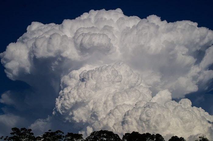
Photo: sandid via Pixabay, CC0
If the atmospheric conditions are unstable enough, not only do many clouds form, but cumulus clouds might experience substantial vertical growth, leading to precipitation. Cumulus congestus, also known as towering cumulus, are cumulus clouds that have grown heavy with water molecules and often bring rain. If cumulus clouds are able to keep growing they can become cumulonimbus clouds, which are typically associated with more intense rains and thunderstorms.
“Into each life some rain must fall.” — Henry Wadsworth Longfellow
Cumulonimbus clouds are frequently referred to as “thunderheads”, and the size of the clouds amplifies electrical interactions between the ground and the clouds, creating lightning and thunder. Thunderheads are often referred to as “anvil clouds” because they frequently are shaped like anvils, having a dark, wide base low to the ground with a stretching cloud head that looks flat on top. The base of thunderheads can often be only 1000 feet off the ground, but the top of thunderheads can reach up to 50,000 feet into the air. Because of the atmospheric instability that creates cumulonimbus clouds, thunderheads often arrive with high-intensity wind and powerful, unpredictable drafts. These cumulonimbus clouds and the accompanying weather systems can often give rise to damaging hail, supercell storms, intense wind shears, and tornadoes.
The particles of air within the clouds are moving past one another at high speeds, which creates electrical charges. The electrical charges must discharge somehow, which is what creates lightning. Lightning can happen within a cloud, between clouds, or from cloud to ground. Thunder is what happens when lightning strikes occur, created by the sudden increase in temperature and pressure which contracts the air. As the air rapidly expands back outwards, it creates a tremendous cracking noise and the reverberations of this sound are what we hear as thunder.
A thunderstorm begins to dissipate when the downdrafts within the cloud end up becoming stronger than the updrafts. The moist, warm air can no longer rise upwards, so the water droplets in the cloud stop forming. The rain begins to lighten up as the cloud disappears into the atmosphere, which happens from bottom to top.
Nimbostratus Clouds
“Sunshine is delicious, rain is refreshing, wind braces us up, snow is exhilarating; there is really no such thing as bad weather, only different kinds of good weather.” — John Ruskin
Nimbostratus clouds are another type of cloud that often brings rain. If you look up at the sky and there is nothing but a uniform, gray, low layer of clouds you’re probably viewing nimbostratus clouds. Nimbostratus clouds are thick with water and block out sunlight, and they form at low or middle altitudes. While cumulonimbus clouds usually bring short-lived but intense storms, nimbostratus clouds usually bring less intense rain that can last for hours or longer. Nimbostratus clouds typically have a cloud base of around 6500 feet, meaning that they usually have water droplets in them, not ice crystals. Although, if ambient temperatures are low enough snow or ice may fall.
Related Posts
 Duck-Billed Dinosaurs Uncovered In Aniakchak, Alaska
 Cryptic Diversity In Vietnam’s Limestone Karst Habitats
 An Improved Method To Remove Debris From Cyst Nematode Egg Suspensions And Computer-Aided Technologies For Egg Counting
 The Footprints Of Urbanization, Industrialization, And Agriculture On River Beds: Heavy Metal Contamination Assessment And Source Identification In River Sediments In Eastern China
 Aging Dolphins Via Pectoral Flipper Radiography
 Glycoalkaloids In Potatoes: The Effect Of Biostimulants And Herbicides