


Google Earth is easily one of Google’s most amazing programs. The program uses a compilation of satellite imagery and photography to create an interactive 3-D planet Earth that users can interact with and view from many different angles, at different resolutions, and with different filters. How can you get the most out of Google Earth’s images and maps? What are some tips and tricks that will allow you to gain the maximum amount of enjoyment and education from the program?
Searching The World With Google Earth
To begin with, you can use Google Earth in Google Chrome, if you would prefer to use it in an internet browser and not have to download the application. However, some of the features that are available in the desktop version that doesn’t seem to be available in the browser version (at least at the time of this writing).
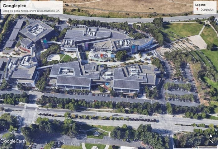
Photo: Google Earth, Google
Google Earth can be downloaded and use on Windows, Lennox, Mac OS, iOS, Android, and even the Xbox One. After installing Google Earth you will find that it is quite easy to search for a specific place. The search field is compatible with many different forms of text. You can input postal codes, ZIP Codes, town/city names, latitude-longitude coordinates, and even natural language place names. For instance, you can try searching for “Seattle, Washington” or more generic terms like “World Heritage Site.” After you’ve conducted a search for an area, the program will move you to that destination, and you’ll be able to zoom in or out at the destination and drag the map around to see things from different angles. You can spin the wheel found in the top right corner to change angles and get a 360° view of areas.
“Maps encourage boldness. They’re like cryptic love letters. They make anything seem possible.” — Mark Jenkins
If you’re looking for an extremely detailed view of an area, you can switch to Street View. Google Street View allows you to see things at street level, with shocking amounts of detail. While you move around the street level, the coordinates of your position will be displayed on the screen, as well as some other information such as an “Image Date.” The Image Date reflects the date that the image you are looking at was taken on. You can scroll through these dates to see the location at different points in time. You can often see what streets were like a few years or so ago, and some famous landmarks even have photos of them that date back many years.
Filters And Flights Sims
On the left-hand panel, there are a variety of layered buttons and filter options. For instance, turning on the weather option will allow you to see clouds, snow, and rain on the map, much like if you were watching a weather broadcast or viewing the interactive maps on a weather site.
The system also has options to turn on public transportation lines, like streetcars and subways, so that you can see where transportation routes in certain cities go. This is available mainly in the large metropolitan areas. The program has a Wikipedia option, and enabling this feature will give you quick links to Wikipedia articles on areas you visit in Google Earth. Similarly, there’s a National Geographic option, which will provide you with links to articles that National Geographic has written on famous locations such as the Grand Canyon and Mount Fuji.
Google Earth doesn’t just have data on the Earth’s landmasses, it also can show you underwater locations and images. Turning on the ocean layer will allow you to explore certain parts of the ocean, examine shipwrecks, see protected marine areas, and even track certain marine creatures.
“A map is the greatest of all epic poems. Its lines and colors show the realization of great dreams.” — Gilbert H. Grosvenor
By clicking on the sun icon near the top, you can control how much daylight is seen in the region that you are looking at. By adjusting the slider, you can see the Earth at various times of the day. If you like viewing things at night, you can also go to the NASA section of the options, and turn on Earth City Lights, which will display what the Earth looks light at night, illuminated by street lights.
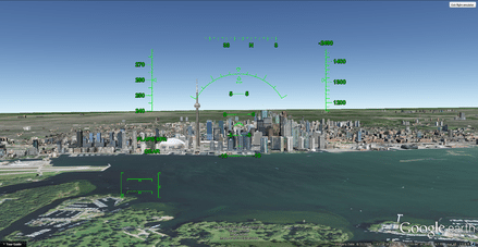
Photo: Google Earth, Google via Wikimedia Commons
The many various layer options are quite impressive and amazing in their own right, yet Google Earth even has its own flight simulator built into it. Though the flight simulator was initially an Easter egg when it was first introduced back in 2007, it is now out in the open for everyone to use, and can be easily controlled using a mouse or joystick.
You can activate the flight simulator by going to the “tools” section on the toolbar up top, or by using the keyboard shortcut: Ctrl + Alt + A. The flight simulator allows you to select between two aircraft, an F-16 or an SR 22, and lets you set your starting position to either your current position on the globe or at certain airports. As mentioned, if you have a joystick you can use with your computer, the experience can be enhanced with a flight stick.
Mars, The Moon, And More
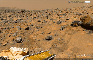
Photo: Google Earth, Google via Wikimedia Commons
Though the program is called Google Earth, You can actually explore parts of Mars and the moon through it. The Google Moon feature was brought to the program for the 40th anniversary of the Apollo 11 mission, and you can take several guided tours through the program including one based on the Apollo missions. These tours use videos and images and allow you to move across sections of the moon Street View style. Likewise, Google Mars is an extension of that concept, which allows you to browse certain sections of Mars‘ surface. You can view high definition images taken by Spirit, Opportunity, and other Mars landers. You can also use Google Sky, which allows you to take a good look at constellations, stars, moons, and other space bodies, thanks to images from the Space Telescope Science Institute.
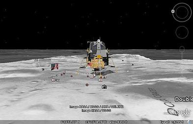
Photo: Google Earth, Google via Wikimedia Commons
“The earliest maps were ‘story’ maps. Cartographers were artists who mingled knowledge with supposition, memory and fears. Their maps described both memory and events, which had taken place within it, enabling travelers to plot a route as well as to experience a story.” — Rory MacLean
Google Earth in Chrome also has a feature called Voyager, which allows you to create and experience “geospatial storytelling”. You can listen to stories and watch videos created by companies like PBS and National Geographic. You can follow pre-set paths of exploration and learn about various regions through guided tours like this. Google Earth also lets you create your own custom voyages by bookmarking places in a certain order, and then experience them in this order whenever you want. These custom tours can also be shared with others. Finally, if you head to the Google Earth Education page, you’ll find certain pre-made tours and educational tracks you can view.
Related Posts
 Improving Tools For Quality Improvement: Crossings, Runs, And Crossrun
 Coherent Poly Propagation Materials With 3-Dimensional Photonic Control Over Visible Light
 Reconstructing Commuter Networks Using Machine Learning And Urban Indicators
 Surprising Internal Structure Of Whole Wheat-Green Gram Functional Bread
 Tailoring Tomatoes To Match Individual Consumer Needs
 Eavesdropping On “Classroom Talk” In Undergraduate STEM Classrooms