


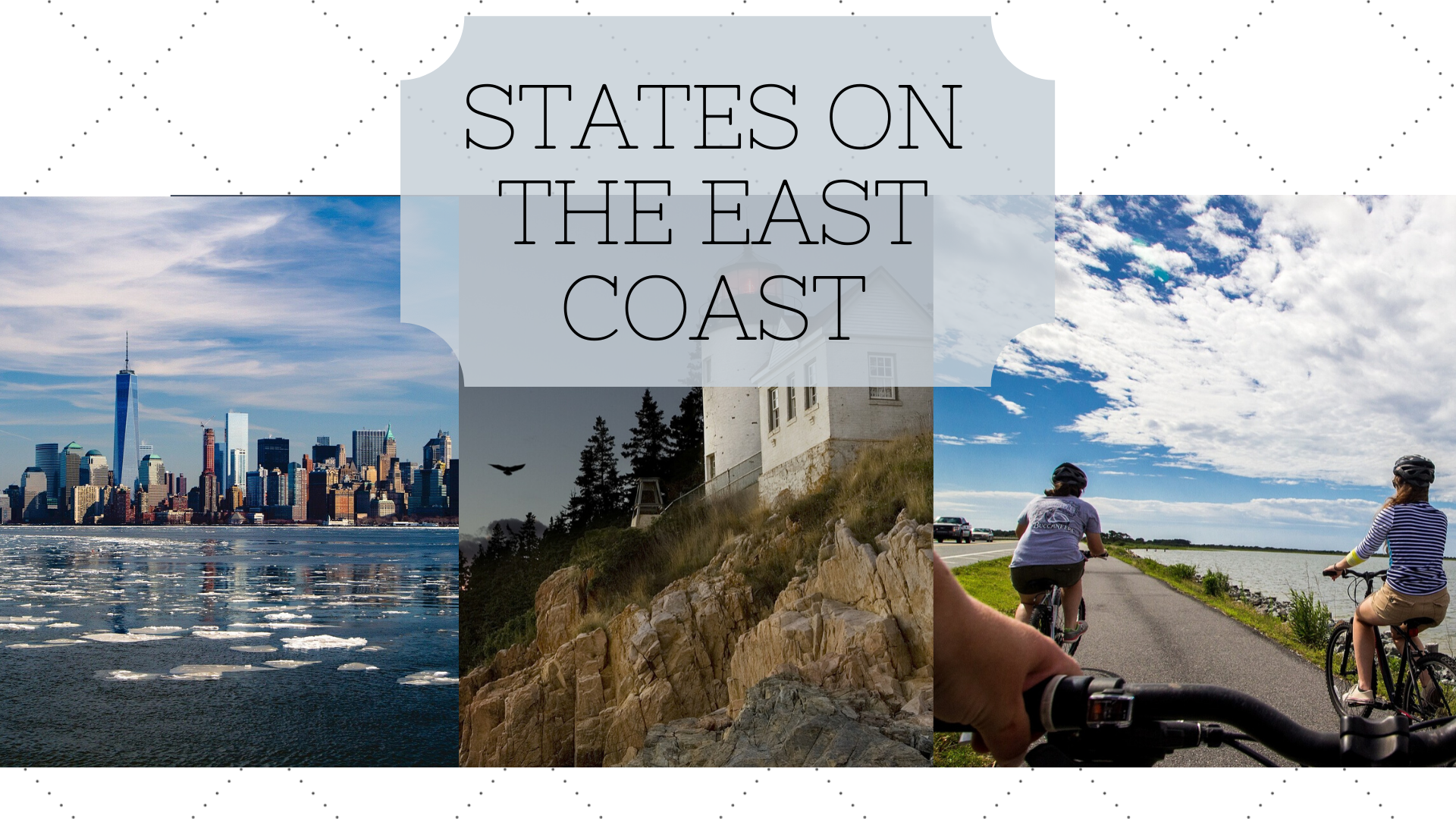
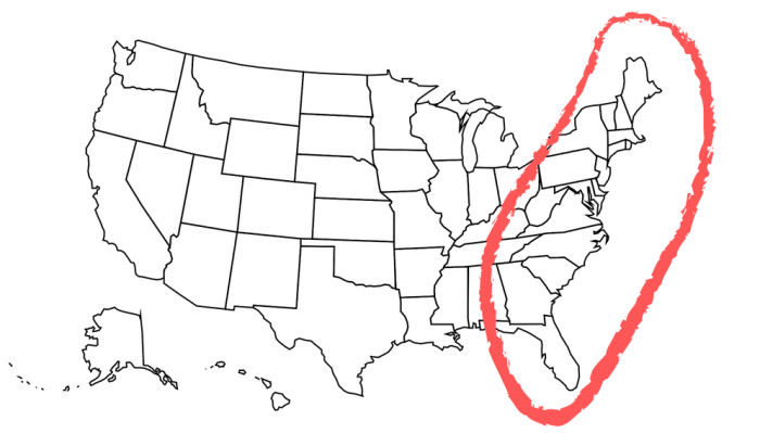
The map of the East Coast of USA consists of 14 states; Florida, South Carolina, Georgia, North Carolina, Maryland, Virginia, Delaware, New York, New Jersey, Rhode Island, Connecticut, Massachusetts, New Hampshire, and Maine.
The East Coast is extremely important historically and today as well. To learn all about the East Coast of the United States, as well as to see a map of the East Coast, check out this guide.
When you’re from the East Coast or you’re from the South, people expect you to sound a certain way. So if you don’t sound that way, people won’t label you as that type of artist. For me, I had a whole new lane to create for myself being from Pittsburgh and being a Midwest artist. – Wiz Khalifa
Map Of The 13 Original Colonies Along The USA East Coast
The Thirteen Colonies were located across the eastern seaboard of what eventually became the United States of America. The first established colony was the Colony and Dominion of Virginia in 1607. This was an English settlement that was founded by the people who came over to America with the Plymouth Company ships. There was also a settlement founded in 1620 called Plymouth, named after the Plymouth Company. The Plymouth Colony location was mapped out and surveyed by Captain John Smith, and the actual colony of Plymouth was founded by a group of Puritans (who we now call pilgrims).
| Original Colonies In Order of Foundation | |||
| Name | Year Founded | Region | Statehood Order |
| Virginia | 1607 | South | 10th |
| New York | 1626 | Middle | 11th |
| Massachusetts | 1630 | New England | 6th |
| Maryland | 1633 | South | 7th |
| Rhode Island | 1636 | New England | 13th |
| Connecticut | 1636 | New England | 5th |
| New Hampshire | 1638 | New England | 9th |
| Delaware | 1638 | Middle | 1st |
| North Carolina | 1653 | South | 12th |
| South Carolina | 1663 | South | 8th |
| New Jersey | 1664 | Middle | 3rd |
| Pennsylvania | 1683 | Middle | 2nd |
| Georgia | 1732 | South | 4th |
| Settlement | |||
| Plymouth Settlement | 1620 | New England | Became Plymouth, MA |
The population in these colonies grew rapidly, and by 1775, there were well over 2 million colonists spread among the 13 colonies. In the colonies, slavery was practiced and was a massive part of their economy. They were more prevalent in the southern colonies where plantations existed, but there were some slaves in the northern colonies as well. Over 160 there were about 280,000 slaves sent to the colonies, which came out to 2% out of the total amount of slaves traded during the Atlantic slave trade.
Tensions began to rise between the colonies and England going into the later 1700s. Many people lived in the colonies but had no government representative in parliament back in London. The British began heavily taxing the colonists, causing tempers to flare up and eventually sparked the famous Boston Tea Party. Soon the colonists saw the King of England as a dictator which actually led to the people who lived in America to decide to fight for their independence. The first battle of the American Revolution was in 1775 in Lexington and Concord. In 1776 America fought, and won, to become its own entity, eventually named the United States of America.
Map Of The United States East Coast
You may have noticed the list of the colonies don’t include the states of Maine and Florida. Maine was actually considered to be a part of Massachusetts and achieved its statehood in 1820, years after the American Revolution. Florida was owned by Spain and the United States was given it with the Adams – Onis Treaty in 1819 (this actually took effect in 1820). In 1845, Florida achieved its statehood.
The Eastern seaboard is important historically because it was truly the birthplace of the United States. Americans declared their independence with the Declaration of Independence in Philadelphia, the first battle of the American Revolution was in Massachusetts, and we won the Revolution with the surrender of General Cornwallis in Virginia. It was from the East Coast that Americans began making their way out West, essentially creating the rest of the United States. It was along the East Coast where the Civil War was fought in the late 1800s and where slavery was forbidden. It is along the East Coast where the capital of the U.S. is and where our government makes decisions that affect the country (and at times the world).
The East Coast of the United States
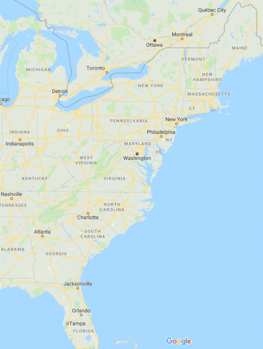
The map of the East Coast. Image source: Google Maps
Now let’s go over the map of the East coast of the United States of America. There are 14 states that border the Atlantic Ocean, which allows the U.S. to be able to trade with the western parts of Europe and Africa. These states, as we said above, are the first states the United States had, and there are many historical places to check out along the East Coast.
| States, Capitals, and Population | ||
| States | Capital | Population (as of 2017) |
| Florida | Tallahassee | 20.9 million |
| Georgia | Atlanta | 10.4 million |
| North Carolina | Raleigh | 10.2 million |
| South Carolina | Colombia | 5 million |
| Maryland | Annapolis | 6 million |
| Pennsylvania | Harrisburg | 12.8 million |
| Virginia | Richmond | 8.4 million |
| Delaware | Dover | 961 thousand |
| New Jersey | Trenton | 9 million |
| New York | Albany | 19.8 million |
| Connecticut | Hartford | 3.5 million |
| Maine | Augusta | 1.3 million |
| New Hampshire | Concord | 1.3 million |
| Rhode Island | Providence | 1 million |
The East Coast is in the Eastern time zone, which means that it is 3 hours ahead of the Pacific time zone in America (it is 5 hours behind UTC). With all of the states combined, the population of the East Coast is 112.6 million. The East Coast has a higher population than the West Coast along the Pacific Ocean.
“After seeing the devastation on the East coast. I’ve concluded that Sticks and Stone might break our bones. But Mother Nature can really tear up your stuff,” ― Stanley Victor Paskavich, Return to Stantasyland
The East Coast has 3 different climate regions. The northernmost part of the East Coast (from Maine down to Connecticut) is considered to have a continental climate. That means the summers are warm and the winter is snowy and cold. Southern Connecticut down towards Florida is considered to be temperate. That means cold winters and hot summers. The southern part of Florida has a tropical climate, meaning it is hot all year round. The states along the East Coast are all susceptible to hurricanes, some of which can be severe like Hurricane Sandy in 2012. Hurricanes can land anywhere along the East Coast and hurricane season lasts from June until November, so for the majority of the year people along the Atlantic are on alert just in case a hurricane comes in.
Related Posts
 Duck-Billed Dinosaurs Uncovered In Aniakchak, Alaska
 Cryptic Diversity In Vietnam’s Limestone Karst Habitats
 An Improved Method To Remove Debris From Cyst Nematode Egg Suspensions And Computer-Aided Technologies For Egg Counting
 The Footprints Of Urbanization, Industrialization, And Agriculture On River Beds: Heavy Metal Contamination Assessment And Source Identification In River Sediments In Eastern China
 Aging Dolphins Via Pectoral Flipper Radiography
 Glycoalkaloids In Potatoes: The Effect Of Biostimulants And Herbicides