Understanding visitor use in public parks is important for making decisions about how to best sustain both recreational activities and ecosystems. Specifically, knowing where visitors go helps park managers effectively allocate resources to support ecosystems and high-quality recreation simultaneously. But in remote and expansive wilderness areas, identifying where visitors go is less known.
A recent study titled “A GPS Tracking Study of Recreationists in an Alaskan Protected Area” used GPS units to understand where backpackers traveled within Denali National Park and Preserve (“Denali”).
Backpacking in Denali National Park
Denali is located in interior Alaska, encompassing a six-million-acre subarctic landscape. The park famously hosts the tallest mountain in North America (Denali, 20,310 feet) and supports an abundance of large mammals including wolves, moose, grizzly bears, and caribou by protecting large pristine ecosystems. In addition to ecological importance, Denali provides unique recreational experiences for visitors. Two million acres of the park is federally-designated wilderness, but the wild doesn’t stop there: all 6 million acres of the park offer untrammeled and pristine landscapes, solitude and quietude (ability to be surrounded by only natural sounds), and no motorized access.
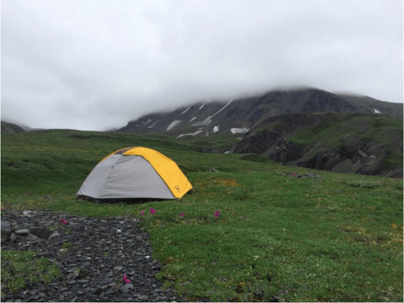
An especially wild experience for visitors is the fact that most of the park is trail-less. Beyond the frontcountry areas where a few established campgrounds, visitor centers, and trail systems are located, hikers and backpackers are instructed to stay off-trail and to not follow anything resembling a “social” trail in keeping with the park’s “Find Your Own Trail” motto. This is a purposeful management strategy to disperse visitor use in fragile tundra ecosystems.
Backpackers access the wilderness via a 92-mile road corridor that bisects the park, using it as a launching point into the backcountry. Once in the backcountry, visitors choose where they want to hike and camp and what features they want to see. Backpackers are only geographically limited by the park’s unit quota system. Denali is segmented into 87 backcountry units as a way to manage this vast landscape. About half of these units have limits on the number of visitors that can camp in a unit on any given night, ranging from two to twelve visitors. This quota system facilitates dispersion of use which has both social (i.e., more solitude) and ecological (i.e., less environmental degradation) benefits.
GPS Visitor Tracking
Visitors tracked with GPS occurs in a wide range of contexts, from public parks to city centers. This technology captures on-ground travel patterns and creates detailed and accurate spatial data. In this study, GPS units tracked backpackers in Denali to examine where they hiked and camped. The researchers distributed GPS units to backpackers who agreed to the study. We used Canmore GT-740 FL units due to their small size and simple design (see pictured). These units were also able to capture very detailed tracks by recording waypoints every 15 seconds.
Trip length data collected from these units allowed researchers to understand how long backpackers trekked in addition to where they went. In all, 113 trips were logged using these units. On average, the backpacking trips lasted about three days, covering approximately 18 kilometers (17.84 km; 12.26 mi). The lengthiest trip recorded was ten days long.
Use is Concentrated Despite No Trails
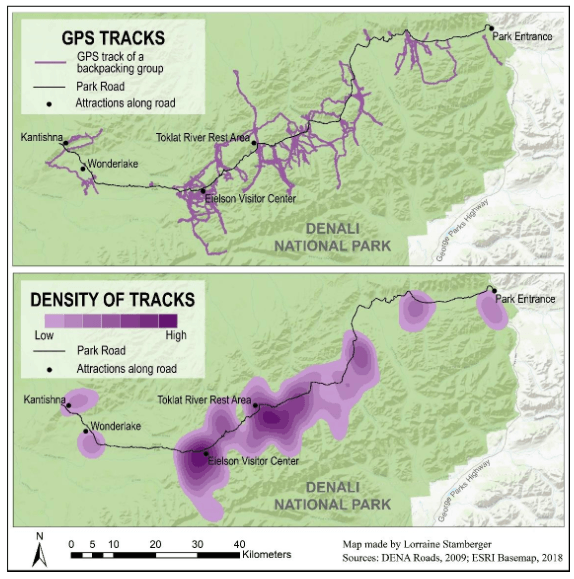
To the surprise of researchers and park managers, GPS tracks of backpackers were concentrated in specific locations. The map shows where these concentrated hotpots were located. Most backpackers chose to camp and hike along the middle sections of the 92-mile park road. The tracks of backpackers were the most dense near the Eielson Visitor Center and the Toklat River Rest Area. There were less dense pockets of GPS tracks at the park entrance and near the end of the road by the Kantishna and Wonderlake areas.
These concentrated patterns of the GPS tracks might exist for a few reasons. First, the densest track locations were at relatively high elevations. Hiking at higher elevations in Denali tends to be easier due to drier conditions compared to the boggy and brushy conditions at lower elevations. Second, backpackers could have wanted to visit similar features in the landscape such as scenic mountain peaks, rivers, and glaciers. Finally, because the GPS tracks were concentrated near stops along the road such as the Eielson Visitor Center, backpackers might have been more comfortable setting out into the wilderness from an established site with amenities such as bathrooms and water.

Maps of GPS Tracks and Density of Tracks based on 113 separate backpacking groups. Adapted from https://doi.org/10.1016/j.apgeog.2018.02.011
Future Research
GPS tracking is valuable in a variety of contexts. This study showed GPS technology in action for logging multi-day trips in the remote backcountry of Alaska for purposes of visitor use management. The future of GPS tracking has wide-reaching potential as the technology continues to improve and expand. Recent research has found alternative, possibly more convenient, ways to collect spatial information from backpackers through the use of personal smartphones. Studies like these will continue to aid in the betterment of managing our public parks and protected areas.

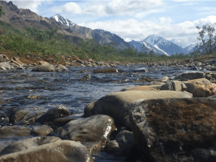
Rivers in Denali National Park are often followed by backpackers for navigating the park. Photo Credit: Lorraine Stamberger
These findings are described in the article entitled A GPS tracking study of recreationists in an Alaskan protected area, recently published in the journal Applied Geography. This work was conducted by Lorraine Stamberger and Carena van Riper from the University of Illinois at Urbana-Champaign, Rose Keller from the National Park Service, Matthew Brownlee from Clemson University, and Jeff Rose from the University of Utah.


