


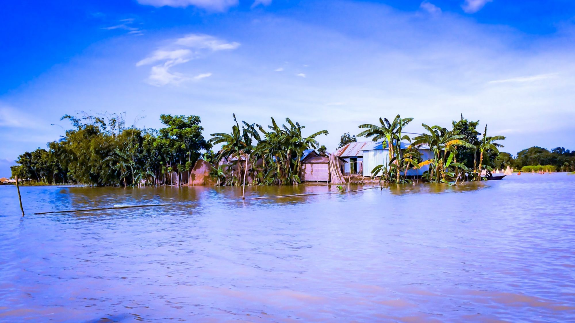
The understanding of water-food complex interrelations represents an important step to enhance the agriculture resilience. Usually, we tend to frame water issues in agriculture from the water scarcity perspective but, according to FAO, between 2003 and 2013, floods have been the most impacting natural disaster on crop production. The effects of floods can be extremely relevant especially in developing countries where extreme hydrological events can strongly jeopardize their primary access to food, i.e. agriculture.
To quantify the effects of a flood event on local food security, we developed a methodology based on remote sensing data that rapidly determine crop losses due to submergence. We selected the events in Bangladesh (2007) and in Pakistan (2010) as exemplary case studies, because of their vulnerability to floods and the importance of agriculture in their territories. These case studies are characterized by significant differences in their agricultural production (mainly rice in Bangladesh and sugarcane, rice, and wheat in Pakistan) allowing us to evaluate the effects of flooding on crops with different resistance to submergence.
Our methodology integrates remote sensing data with agricultural statistics and water footprint values in order to (i) evaluating the potentially affected agricultural areas; (ii) converting the affected areas into crop loss; (iii) estimating the associated calories and water footprint losses.
Firstly, we intersected the remotely sensed flood maps with administrative and land use maps of the area of interest to evaluate the potentially affected agricultural land. Then we converted the potential agricultural land losses into effective crop loss taking into consideration the peculiarities of topography, land use and crops characteristics for the selected study area. Following, the effects of the flood on food availability is evaluated both converting crop losses into lost calories and Water Footprint (WF). We used lost calories as a direct estimation of the crop losses while the WF to provide an indirect evaluation of population involved.
For the Bangladesh 2007 flood event, we estimated an average loss of 103 kcal/cap/day due to flooded rice. The energy deficit represents on the average the 4.3% of the annual energy provided by the entire food production of Bangladesh in 2006, and it raises to 16.5% (equal to 398 kcal/cap/day) in the most affected districts. These percentages assume an even higher importance if we consider that flood contributed to worsening the already critical situation of food supply in Bangladesh (already suffering a 19.4% calories deficit).
The same happened in Pakistan where 2010 flood reduced an already scarce food supply. We estimated a reduction of production around 19% for sugarcane and 40% for rice, resulting in a total of 205 kcal/cap/day lost, equal to the 8.5% of the Pakistan average food supply. Based on the existing statistics, we converted the lost food in terms of WF. In Bangladesh, the results show a total WF loss of 4.72E+09 m3 (equal to 4.4% of the national WF) while in Pakistan the total WF loss is 1.84 E+10 m3 (equal to 13.5% of the Nation WF).
These results can be combined with other spatial analysis to provide a broader understanding of the flood effects on a territory. For example, in fig.1 we identify the hotspots areas where flood strikes the poorest areas, providing a spatial information that can help identify the most urgent location for intervention.
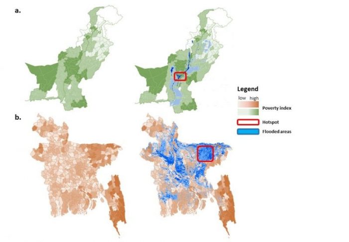
Fig.1 Identification of the poorest area affected by flood (a) Pakistan (b) Bangladesh (Image credit: Tommaso Pacetti)
Flood risk has many hidden connections with environmental, social and economic spheres that need to be analyzed to develop effective integrated water-land management strategies. Our study makes a little step in this direction showing how remote sensing data can be mixed with on-site information to assess the effects of the flood on agriculture and how this information can be useful to enhance the resilience of local food production systems.
These findings are described in the article entitled Floods and food security: A method to estimate the effect of inundation on crops availability, recently published in the journal Advances in Water Resources. This work was conducted by Tommaso Pacetti from the University of Florence, Enrica Caporali from the University of Florence, and Maria Cristina Rulli from Politecnico di Milano.
Related Posts
 Duck-Billed Dinosaurs Uncovered In Aniakchak, Alaska
 Cryptic Diversity In Vietnam’s Limestone Karst Habitats
 An Improved Method To Remove Debris From Cyst Nematode Egg Suspensions And Computer-Aided Technologies For Egg Counting
 The Footprints Of Urbanization, Industrialization, And Agriculture On River Beds: Heavy Metal Contamination Assessment And Source Identification In River Sediments In Eastern China
 Aging Dolphins Via Pectoral Flipper Radiography
 Glycoalkaloids In Potatoes: The Effect Of Biostimulants And Herbicides