Glaciers play a crucial role in environmental systems, they act as freshwater reservoirs for millions of people around the world and are the basis for socio-economic activities such as hydropower or agriculture.
Due to global warming and their substantial worldwide retreat, they became an emerging research object. The present variability of glaciers is an indicator of changing climate conditions and is monitored and intensively studied. However, to make accurate predictions about future glacier variations, we need to improve our understanding of the magnitude, timing, and causes of former climate variability and glacier retreat. Thus, it is crucial to look into climate history and the effects of the changing climate on glacial environments. An often overlooked source of palaeoclimatic information is the remnants of former glaciers and associated landforms which can act as fingerprints of a former changing climate. Periglacial and related landforms bear the potential to reconstruct climate conditions and can help to improve our comprehension of the links between geomorphic processes, landform development and changes in climate. Therefore, it is essential to put these landforms on a solid chronological foundation.
We explored the palaeoclimate potential of periglacial and related landforms in the western fjord region of South Norway during the Holocene in our recently published article in The Holocene. Scandinavia, particularly Norway, is well suited to dive into that matter. On the one hand, the Fennoscandian Ice Sheet was one of the largest ice sheets during the Last Glacial Maximum (LGM) and had a significant influence on the climate system. On the other hand, we can find a wide variety and abundance of periglacial landforms there.
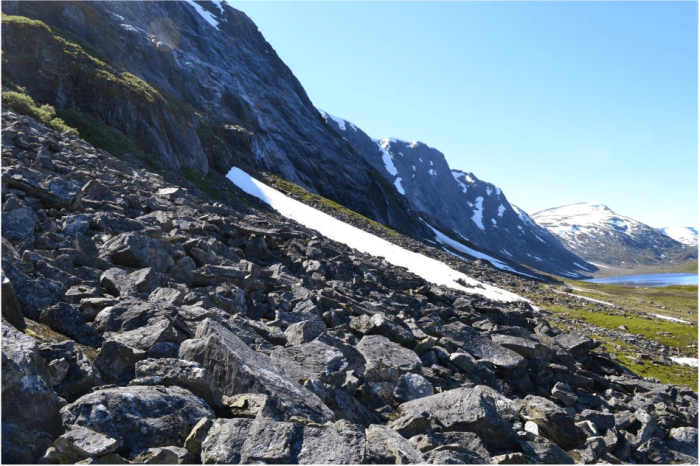
You might wonder, “What are those rocky periglacial and related landforms?” We investigated boulders integrated into landforms such as moraines, rock-slope failures (RSF, Figure 1) and pronival ramparts (Figure 2). In order to date the landforms, we used the Schmidt hammer. This tool was originally designed to test concrete hardness in the 1950s but is used in the geomorphological arena for decades. The Schmidt-hammer applications in geomorphology focus on its capability to differentiate the ages of landforms by associating the compressive strength of rocks to the extent of surface weathering, which allows estimates about the length of surface exposure. This technique was mostly used to relatively date coarse rock landforms but was recently developed towards a numerical dating method, Schmidt-hammer exposure-age dating (SHD). In order to apply SHD, we used two independently dated landforms (young and old) as control sites from which we calculated a calibration curve. With these assumptions and precautions (e.g. certain measuring standards, suitable geological circumstances) we began to investigate different periglacial and related landforms to explore their palaeoclimatic potential.

Figure 2: Part of a pronival rampart in our research area. Image courtesy Philipp Marr.
We successfully applied SHD in this part of Norway for the first time and dated landforms which previously remained unexplored. Our findings show that some landforms were ice-covered until the end of the ‘Finse Event’ (a cold period during the Holocene about 8400-8000 years ago) and became ice-free during the Holocene Thermal Maximum (HTM). Most RSFs in our study stabilized during the HTM; consequently, we cannot confirm the hypothesis that they occur shortly after deglaciation by our results. Additional findings concerning the RSFs infer that their occurrence is a combination of factors acting during climatic warming (e.g. permafrost degradation, enhanced snowmelt, and freeze-thaw activity) and the long-term stress release after deglaciation. Besides landform dating, we were also able to make statements about the involved geomorphic processes.
The results from the moraine and the pronival rampart imply that they did not form during one event but that they inherit complex formation histories, were reworked by a glacier re-advance or reactivated. In comparison to comparable landforms in east-central South Norway, it appears that the landforms in the maritime fjord region in west Norway react more sensitive to past climatic changes.
In our study, we could show that periglacial and related landforms are relevant subjects to shed light on palaeoclimate variability. Due to the high abundance of these landforms in many areas worldwide, they bear a great potential to improve our understanding between landscape evolution and the changing climate. The application of SHD helps to survey cost and time efficiently and to assess previous or establish new deglaciation chronologies. The landscape we see today inherits past climate fluctuations and glaciation history which need to be uncovered to predict future glacier dynamics.


