


Human activities have profoundly changed most of the ecosystems in different regions of the Earth, causing widespread loss of biodiversity and loss of ecosystem functions and services. Excessive removal of specimens from nature is considered one of the most important threats to the world fauna and different studies show that, in general, the hunting activities in the Neotropics are carried out in an uncontrolled way and therefore impactful, making populations unviable and some natural resources unsustainable of fauna.
Wildlife has been a resource to humans since before our lineage diverged from other primates, more than 6 million years ago in Africa. Humans have interacted with wild mammal species of many different forms throughout history. This has promoted relationships that vary according to different human cultures and which are reflected in negative or positive effects on the wild mammals involved. In addition to its meat being used as an important protein source, wild mammals have been widely used in the creation of artifacts such as props, as a source of energy to move or transport, and have been used as sources of beauty and inspiration, or symbols of gods in religious rituals.
Hunting of wild animals occurs throughout the Neotropical region, carried out by indigenous, rural, or urban populations. Hunting can be considered as a cultural trait strongly rooted in the Neotropics and considered in several aspects, depending on the human community in question and the region considered. The considerable progress in living conditions recorded in the second half of the twentieth century resulted in unprecedented urbanization, as well as an improvement and dynamization of the productive processes of animal protein (meat) and its derivatives. Together with the advancement of the perception of values of the importance of the preservation of natural resources, hunting started to be discussed more intensely in society. Many groups have advocated an unrestricted ban on hunting, especially sport hunting.
The rapid and continuous increase in human population density nearby forest ecosystems, especially in tropical regions, have increased access and facilitated harvesting, hunting and poaching activities. In Congo’s forests, for example, human population growth as a result of the setting up of logging companies and the expansion of highways, have further boosted the extraction and sale of wild animal meat in the region’s markets. Due to its long history of occupation and destruction after European colonization, the remaining fragments of forest and the few Reserves in the Atlantic Forest biodiversity hotspot become easily accessible by poachers.
Unfortunately, poaching is still widespread even in protected areas, partly due to the high cost of monitoring and combating poaching over large areas. To better focus conservation efforts within protected areas, it is still necessary a better understanding of the spatial distribution of poaching activities. The scarceness of quantitative information on poaching distribution is partly explained by the fact that poaching activities occur under the forest canopy, which hampers its monitoring by conventional remote sensing techniques. Instead, investigation of poaching patterns often requires in situ techniques that can compromise both the spatial extent and the number of survey repetitions, as well as result in an increased cost of the research activity.
Therefore, studies are urgently needed to predict potential poaching areas and to identify the set of conditions that favor this activity, to maximize the efficiency of surveillance efforts and to better support the decision-making process aiming at wildlife protection. Here, we have tested an approach to predict potential poaching sites using a methodology called occupancy modeling. Occupancy modeling is an analysis proposed by Mackenzie and collaborators in 2002 that is based on the construction of a detection history in each sample unit and estimates the proportion of area occupied by the species (i.e. poachers) as well as the probability of detection. This type of approach can overcome common methodological errors when compared, for example, with modeling based on presence-absence data, which implicitly may contain detectability errors, generating “false absences.” Such errors, if not considered, can produce distorted results, with omission errors (non-detection when the individual is present). The innovative methodological approach used here, as well as the findings of our empirical study, may advance understanding and combating poaching activities in different protected areas.
This study was conducted in the Vale Natural Reserve (VNR), a private protected area of 23,500 ha belonging to the Vale Company. The VNR has an environmental surveillance system (locally called Ecosystem Protection) responsible for the protection of the area against threats (e.g., poaching, palm harvesting, logging, and forest fires). Poaching data were generated by the Ecosystem Protection team in the entire VNR considering each poaching event separately (date, location/region of the event, geographic coordinates and type of evidence collected). We used an index of poaching intensity (records/2-km2) within the study area to compare our estimates of poaching hotspots. This index was calculated using the geo-referenced database of 14 years of poaching records collected by the Reserve’s surveillance system. The index was calculated for each grid square to compare with occupancy estimates based on a 1-year camera-trap study. The results found in our 1-year study are about 81% similar to the results of the 14-year monitoring performed by VNR.
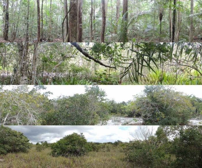
The study area (Credit: Átilla Colombo Ferreguetti)
Our results provide subsidies for increasing knowledge about an illegal but still widespread and common practice. The unique historical poaching data validated the model presented here, highlighting the usefulness of the approach used (i.e. occupancy modeling of camera trapping data) to predict the spatial distribution of poaching. The approach presented here to identify poaching hotspots is cost-effective and much cheaper than 14 years of extensive monitoring, and therefore may be applied in other protected and non-protected areas throughout the world. We recommend that researchers and Reserve managers work together to apply the approach presented here in other Reserves, whenever possible. Camera-trapping has been increasingly used throughout the world, and it is likely that the necessary information to replicate our analyses has already been obtained in many Reserves.
By replicating our analysis in other Reserves, it will be possible to detect patterns and generalizations that will be useful to inform management in different areas. However, we acknowledge that replication may be prohibitive in many areas in developing countries, due to constraints in both human and financial resources. If this is the case, we recommend as a first general guideline to focus surveillance/monitoring mainly near forest edges and water resources.
These findings are described in the article entitled One step ahead to predict potential poaching hotspots: Modeling occupancy and detectability of poachers in the neotropical rainforest, recently published in the journal Biological Conservation. This work was conducted by Átilla Colombo Ferreguetti, Juliane Pereira-Ribeiro, Jayme Augusto Prevedello, Walfrido Moraes Tomás, Carlos Frederico Duarte Rocha, and Helena Godoy Bergallo from Rio de Janeiro State University.
Related Posts
 Duck-Billed Dinosaurs Uncovered In Aniakchak, Alaska
 Cryptic Diversity In Vietnam’s Limestone Karst Habitats
 An Improved Method To Remove Debris From Cyst Nematode Egg Suspensions And Computer-Aided Technologies For Egg Counting
 The Footprints Of Urbanization, Industrialization, And Agriculture On River Beds: Heavy Metal Contamination Assessment And Source Identification In River Sediments In Eastern China
 Aging Dolphins Via Pectoral Flipper Radiography
 Glycoalkaloids In Potatoes: The Effect Of Biostimulants And Herbicides