


The map of Colorado shows just how beautiful the state is. Colorado consists of the Colorado Plateau, the southern Rocky Mountains, and the Great Plains. Geographically, Colorado is the 8th largest state in the United States, the first being Alaska with a total size of 665,000 square miles.
Population wise, however, Colorado is the 21st most populous state with an estimated population of 5.5 million residents. The most populous state in the Union is actually California with 39.5 million people. To learn more about Colorado, and to see the map of this beautiful state, check out this guide.
My district is centered around the progressive college town of Boulder, Colorado, and the high-tech U.S. 36 corridor. It goes from the well-established suburbs of northwest Denver in Adams County to the beautiful mountain towns of Vail and Breckenridge and the majestic Western Slope of the Rocky Mountains. – Jared Polis
Maps of Colorado
As you can see in the map above, the Rocky Mountains take up about half of the state of Colorado (just like we said above). You might also be surprised to notice that Colorado’s borders are manmade and set as opposed to many other states who use natural borders such as lakes, rivers, etc. Below is a chart of the top ten most populated cities in the state of Colorado. What’s interesting is that the majority of these cities can all be found around and near the Denver metropolitan area. Obviously, there are exceptions to this, like Pueblo and Fort Collins, but you get the point.
| Top 10 Most Populated Cities in Colorado (as of 2014) | |||||
| City Name | Date of Incorporation | County | Population | Total Area | |
| 1 | Denver | December 3, 1859 | The City and County of Denver | 663 thousand | 154,000 square miles |
| 2 | Colorado Springs | June 19, 1886 | El Paso County | 450 thousand | 195,000 square miles |
| 3 | Aurora | May 5, 1903 | Arapahoe County, Adams County, and Douglas County | 353 thousand | 154,000 square miles |
| 4 | Fort Collins | February 12, 1883 | Larimer County | 156 thousand | 55,000 square miles |
| 5 | Lakewood | June 24, 1969 | Jefferson County | 150 thousand | 44,000 square miles |
| 6 | Thornton | June 12, 1956 | Adams County and Weld County | 130 thousand | 36,000 square miles |
| 7 | Arvada | August 24, 1904 | Jefferson County and Adams County | 113 thousand | 38,000 square miles |
| 8 | Westminster | May 24, 1911 | Adams County and Jefferson County | 112 thousand | 33,000 square miles |
| 9 | Pueblo | November 15, 1885 | Pueblo County | 108 thousand | 54,000 square miles |
| 10 | Centennial | February 7, 2001 | Arapahoe County | 107 thousand | 29,000 square miles |
Colorado has a total of 64 different counties, as you can see on the map above. Two of those counties, the City and County of Denver, as well as the City and County of Broomfield have consolidated county and city governments. That means the government operates both the county and the city as a whole. Here is a list of all 64 Colorado counties:
- Adams
- Alamosa
- Arapahoe
- Archuleta
- Baca
- Bent
- Boulder
- Broomfield
- Chaffee
- Cheyenne
- Clear Creek
- Conejos
- Costilla
- Crowley
- Custer
- Delta
- Denver
- Dolores
- Douglas
- Eagle
- Elbert
- El Paso
- Fremont
- Garfield
- Gilpin
- Grand
- Gunnison
- Hinsdale
- Huerfano
- Jackson
- Jefferson
- Kiowa
- Kit Carson
- Lake
- La Plata
- Larimer
- Las Animas
- Lincoln
- Logan
- Mesa
- Mineral
- Moffat
- Montezuma
- Montrose
- Morgan
- Otero
- Ouray
- Park
- Phillips
- Pitkin
- Prowers
- Pueblo
- Rio Blanco
- Rio Grande
- Routt
- Saguache
- San Juan
- San Miguel
- Sedgwick
- Summit
- Teller
- Washington
- Weld
- Yuma
In 1861, Colorado became its own territory and began making counties. Here are the original 17 counties of Colorado:
- Summit
- Larimer
- Weld
- Boulder
- Gilpin
- Clear Creek
- Jefferson
- Arapahoe
- Douglas
- Lake
- Conejos
- Costilla
- Park
- Fremont
- El Paso
- Pueblo
- Huerfano
All About Colorado
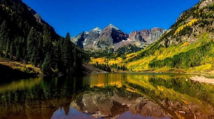
A picture of the Colorado mountains. Image source: Pixabay
Colorado was named after the Colorado River, which the Spanish explorers named Rio Colorado for the red dirt that was carried from the mountains down the river, so Colorado essentially means the color red. In 1861, Colorado was its own territory, and on August 1, 1976, President Ulysses Grant admitted Colorado into the United States as the 38th state to join the union. Colorado has the moniker “the Centennial state” because they became a state a century after the United States Declaration of Independence was signed.
Facts About Colorado
Here are some random, funny, somewhat odd, and super cool facts about Colorado:
- The capital of Colorado is Denver
- The total population of Colorado (estimated for 2017) is 5.6 million
- Colorado’s highest elevation is Mount Elbert, which is in Lake County at 14,440 feet
- Colorado’s lowest elevation is the Arikaree River at 3,317 feet
- This point is actually the highest low elevation point of any state in the union and is actually higher than Washington DC
- Colorado is in the Mountain time zone
- Colorado is the only US state that is entirely above 1,000 feet
- Even though Colorado is very mountainous, it is not very seismologically active
- Its largest earthquake was a magnitude 5.7 that was recorded in 1973
- Its second largest was a 5.3 recorded in 2011
- The epicenter was 9 miles away from the city of Trinidad
- Colorado is the only US state to turn down the Olympic games
- 1976 Winter Olympics were planned to take place in Denver but they canceled at the last minute
- Denver claims to have invented the cheeseburger (thank you Denver!)
- The federal government owns over 1/3 of the land in Colorado
- The United States Air Force Academy is in Colorado Springs
- Pueblo, Colorado has 4 living recipients of the Medal of Honor
- The world’s largest rodeo, the Western Stock show, takes place in Denver
- The “pinto bean” capital of the world is in Dove Creek
- Colorado is one of the states that is part of the 4 corner states
- The 4 corner states are: Arizona, Colorado, New Mexico, and Utah
- The first license plate in the US was issued in Denver
- It’s illegal to throw snowballs in Aspen, Colorado
- The first teddy bear was invented in Colorado
- It was invented to honor Theodore Roosevelt
- Jolly Ranchers were invented by a Colorado native resident
- The first rodeo in the United States took place in Deer Trail, Colorado
- It is illegal to hit obstacles while skiing and snowboarding in Vail, Colorado
- The first stegosaurus fossil was found in Colorado in 1876
- No president has been born in Colorado
- It is illegal to ride your horse while under the influence of alcohol or drugs
Related Posts
 Duck-Billed Dinosaurs Uncovered In Aniakchak, Alaska
 Cryptic Diversity In Vietnam’s Limestone Karst Habitats
 An Improved Method To Remove Debris From Cyst Nematode Egg Suspensions And Computer-Aided Technologies For Egg Counting
 The Footprints Of Urbanization, Industrialization, And Agriculture On River Beds: Heavy Metal Contamination Assessment And Source Identification In River Sediments In Eastern China
 Aging Dolphins Via Pectoral Flipper Radiography
 Glycoalkaloids In Potatoes: The Effect Of Biostimulants And Herbicides