


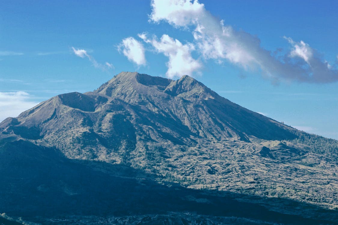
MOUNT AGUNG, the majestic 9,944 feet (3,031 m) stratovolcano on the heavenly island of Bali, Indonesia, might be on the edge of a catastrophic eruption.
Daily tremors have been constantly growing in number and strength over the past week, and the hypocenters – the positions underground where the shaking originates – are becoming shallower, a sign that the level of magma and its pressure are rising, and more and more cracks are opening within the mountain. Volcanologists are still unable to predict when the eruption will occur and how destructive it will be, but they agree that it might be imminent: it might be just a matter of hours. Dr. Svahbana, a seismologist from the Indonesian Volcanology and Geological Disaster Mitigation Center, declared in an interview with The Guardian on Tuesday that such high seismicity from Mount Agung has never been recorded before, that is since continuous monitoring was set up after the last eruption in 1963.
A red-level volcanic alert (the highest level on a scale of four) was issued last Friday, and all tourists and inhabitants were forced to evacuate from a 12-km radius off-limit zone around the crater. As of today, more than 75,000 people have been evacuated from their homes and accommodated in temporary shelters in schools and other public building. Nonetheless, officials have said there is no immediate danger to tourists, usually crowding the southern part of the island, but in the event of an eruption Bali’s international airport would be shut down for days, weeks or even longer, due to the high amount of ash in the atmosphere which can damage aircraft engines.
A stratovolcano, or composite volcano, owes its name from its structure. Differently from shield volcanoes, like Mauna Kea in the Hawaii or the Olympus on Mars, which is entirely built from eruptions of fluid lava, a stratovolcano is made of successive layers of solidified lava and volcanic ashes and pumice. These volcanoes can alternate periods of relative calm, effusive activity, and periods of catastrophic explosions. Their lava is very viscous and rarely travels more than a few kilometers before solidifying completely. On the contrary, they can shoot ashes tens of kilometers high, up to the stratosphere, where the strong jet streams can spread it all over the globe. When another impressive Indonesian stratovolcano, the Krakatoa, erupted in 1883, the explosions were heard in Perth, Australia, more than 3,000 km away, and the shockwave would have made everyone deaf in a radius of 16 km. The ash reached 80 km altitude in the stratosphere, and filtered the solar light and heat to such an extent, that the global temperature fell by 1.2 degrees Celsius in the following summer and global climate patterns took 5 years to recover.
As of today, heedless of the danger, more than 10,000 are still living within the off-limit zone, too close to Mount Agung’s crater, according to what declared by Mr. Nugroho, the Indonesian National Disaster Mitigation Agency spokesperson, during Monday’s press conference. Their lives are at high risk: in 1963, when the eruption came all of a sudden and no monitoring was in place, people had just minutes to run away, and more than 1,000 locals lost their lives. That time, the volcanic activity lasted for almost one year, and further destruction was brought by the following rainy season, which triggered several landslides in the layers of ash and debris deposited after the eruption, killing hundreds of people.
The Indonesian Volcanology Center is now constantly monitoring the situation, using seismic recordings, GPS and satellite imagery, including a thermal camera. Updates and warnings are released periodically on MAGMA (Multiplatform Application for Geohazard Mitigation and Assessment in Indonesia), an App which can be downloaded on Google Play (here) and could be a precious source of information for locals and tourists.
Meanwhile, signs of an imminent eruption have become visible. On Wednesday morning, a column of white smoke, rich in water vapor, was spotted rising several hundred meters above the peak. It does not come from the magmatic chamber though, but it is a sign that high pressure and temperature have reached layers close to the surface, heating and vaporizing the groundwater, which is now escaping through cracks within the rocks like from a giant pressure pot.
Related Posts
 Duck-Billed Dinosaurs Uncovered In Aniakchak, Alaska
 Cryptic Diversity In Vietnam’s Limestone Karst Habitats
 An Improved Method To Remove Debris From Cyst Nematode Egg Suspensions And Computer-Aided Technologies For Egg Counting
 The Footprints Of Urbanization, Industrialization, And Agriculture On River Beds: Heavy Metal Contamination Assessment And Source Identification In River Sediments In Eastern China
 Aging Dolphins Via Pectoral Flipper Radiography
 Glycoalkaloids In Potatoes: The Effect Of Biostimulants And Herbicides