


Are we able to model the urban climate in every city around the globe? Can we properly cope, nowadays, with urban issues and challenges related to their present and future climate?
Well, most of the cities around the globe do not offer sufficient data for studying and modeling their impact on the local climate, hence hindering our abilities to properly design our urban areas in order to adapt and/or mitigate the implied challenges. To cite a few of those, cities’ hotter temperatures – often referred to as the urban heat island – have a strong effect on energetic consumption, on health issues related to heat stress and urban droughts, or even on the spread and prevalence of some diseases such as malaria. Moreover, urban climate studies have suffered from a standardized way of communicating their results globally, accentuating the difficulties in comparing the effect of two distinct cities regarding their climate, and thus, the proper ways to deal with those effects.
Yet, recent efforts by experts in the field have offered a new land use classification which describes the urban environment in a simplified and generic way for urban climate studies. This classification is called the Local Climate Zones (or LCZ) [1]. It makes the assumption that distinct urban structures and materials will have a tangible effect on the local climate, but more particularly, an effect that will be similar and easily explicable across different urban environments. For example, more densely built urban environments will tend to be hotter at night than sparsely built environments. Therefore, the LCZ describe the urban landscape in 10 different classes distinguished by their heights, their density, and their materials. It also offers a simple characterization of the natural landscape in the urban environment, divided into 7 classes.
Now, although LCZ have already proven to be very powerful in easing and generalizing the communication of urban climate studies between urban climate researchers and also with a variety of cities’ actors, it is currently being foreseen as a major tool for urban climate studies by coping with the cities’ data scarcity [2, 3]. In fact, LCZ are defined by ranges of parameters (eg. building heights, impervious surface fraction, albedo…), and can, therefore, allow for the parameterization of urban climate models in places that do not necessarily offer these parameters.
In order to gather this information at a city scale, an international effort, driven by a community of urban climate researchers and called the World Urban Database and Access Portal Tool (WUDAPT; see http://www.wudapt.org), has defined a framework for mapping LCZ through the use of freely-available satellite images [4]. Once the map is obtained, it is possible to extrapolate the urban parameters required by our climate models before studying, and ideally projecting, the impact of urban areas on the local climate.
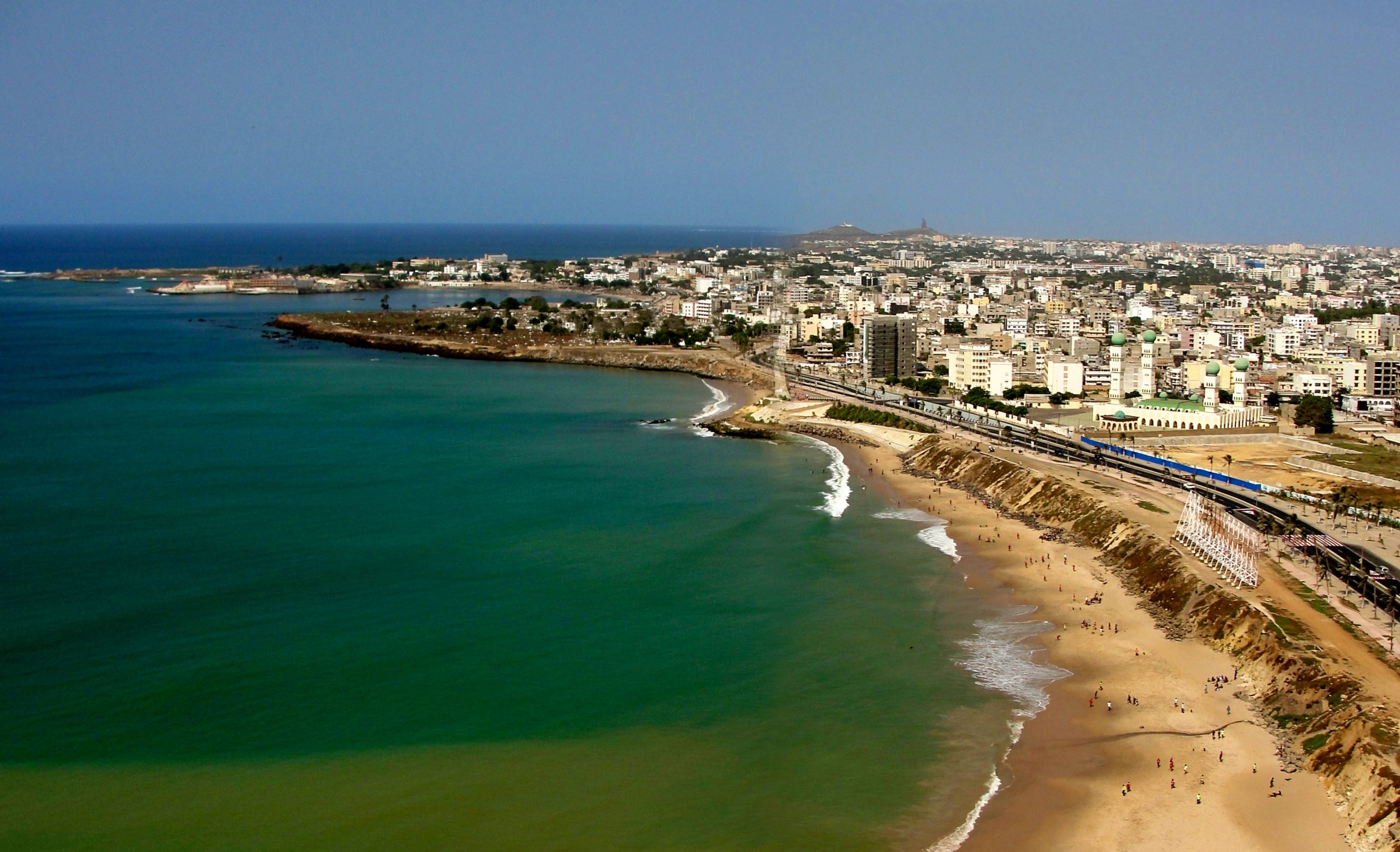
Since previous studies in developed cities demonstrated that the application of LCZ in our models did not deteriorate, but rather improved, the model performances when compared to in-situ measurements, we decided to perform the first LCZ classification in Subsaharan Africa over two cities: Dakar (Senegal) and Kampala (Uganda). The purpose of this work, published in the Urban Climate journal, is to raise awareness on the applicability of LCZ for understanding and studying the climate-related urban health risks in developing cities [5].
Interestingly, we found that the LCZ classification was also representative of the Subsaharan African urban landscape. Still, some improvements of the default urban morphological and physical parameters derived by LCZ could be foreseen via very high-resolution satellite information. Nonetheless, using the default parameters of the LCZ, it was demonstrated that Kampala’s hotter climate could increase the viability of the urban environment for the development of malaria-infected mosquitos by about 15 to 20%.
Yet, this preliminary result did not include the effect of humidity on the survival capacity of mosquitoes and should, therefore, be regarded more as an indicative measure emphasizing the need for more research to be done in the field. In addition, the Kampala capital city of Uganda is home to 3 million people, and its population continues to grow like in many other African cities. The latter further stresses the emergency for more urban climate research to be done and the need to find new ways for overcoming the local data scarcity. This way, more resilient cities can be built, taking into account the health and environmental risks related to the urban climate.
These findings are described in the article entitled Using Local Climate Zones in Sub-Saharan Africa to tackle urban health issues, recently published in the journal Urban Climate.
References:
- Stewart, I. D., & Oke, T. R. (2012). Local climate zones for urban temperature studies. Bulletin of the American Meteorological Society, 93(12), 1879-1900.
- Ching, J., Mills, G., Bechtel, B., See, L., Feddema, J., Wang, X., … & Mouzourides, P. (2018). WUDAPT: An urban weather, climate, and environmental modeling infrastructure for the anthropocene. Bulletin of the American Meteorological Society, 99(9), 1907-1924.
- Brousse, O., Martilli, A., Foley, M., Mills, G., & Bechtel, B. (2016). WUDAPT, an efficient land use producing data tool for mesoscale models? Integration of urban LCZ in WRF over Madrid. Urban Climate, 17, 116-134.
- Bechtel, B., Alexander, P. J., Beck, C., Böhner, J., Brousse, O., Ching, J., … & Hoffmann, P. (2019). Generating WUDAPT Level 0 data–Current status of production and evaluation. Urban Climate, 27, 24-45.
- Brousse, O., Georganos, S., Demuzere, M., Vanhuysse, S., Wouters, H., Wolff, E., … & Dujardin, S. (2019). Using Local Climate Zones in Sub-Saharan Africa to tackle urban health issues. Urban Climate, 27, 227-242.
Related Posts
 Duck-Billed Dinosaurs Uncovered In Aniakchak, Alaska
 Cryptic Diversity In Vietnam’s Limestone Karst Habitats
 An Improved Method To Remove Debris From Cyst Nematode Egg Suspensions And Computer-Aided Technologies For Egg Counting
 The Footprints Of Urbanization, Industrialization, And Agriculture On River Beds: Heavy Metal Contamination Assessment And Source Identification In River Sediments In Eastern China
 Aging Dolphins Via Pectoral Flipper Radiography
 Glycoalkaloids In Potatoes: The Effect Of Biostimulants And Herbicides