


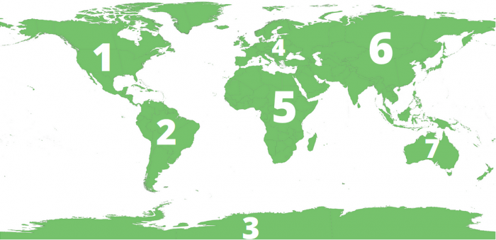
The map of the seven continents encompasses North America, South America, Europe, Asia, Africa, Australia, and Antarctica. Each continent on the map has a unique set of cultures, languages, food, and beliefs.
It’s no secret that we’re committed to providing accurate and interesting information about the major landmasses and oceans across the world, but we also know that words can only go so far. Thus, we’re dedicating this piece to delivering printable images of Earth’s seven continents and all five of its oceans.
A picture is worth a thousand words, according to the old adage. And in the interest of helping our readers to not only understand the different corners of the world but also visualize them, we’ve assembled accessible images that will serve you well.
Nay, be a Columbus to whole new continents and worlds within you, opening new channels, not of trade, but of thought. – Henry David Thoreau
But first, let’s run through the 7 continents of the world:
- North America
- South America
- Antarctica
- Europe
- Asia
- Africa
- Australia
Doing research for a school exam? Simply want to sate your own curiosity? We’ve got you covered, and then some! Read on to get access to reliable images of Earth’s continents and oceans.
7 Continents
Before we delve into the images that we’ve promised, we should establish the type of continental model that we’ll be utilizing as a part of this article.
While some regions of the world still teach six-continent models, we’ll be utilizing the seven-continent model that’s usually taught in most English-speaking countries.
| Four Continents | Five Continents | Six Continents | Six Continents (Alt) | Seven Continents |
| Afro-Eurasia | Africa | Africa | Africa | Africa |
| America | Eurasia | Asia | Eurasia | Asia |
| Antarctica | America | Europe | North America | Europe |
| Australia | Antarctica | America | South America | North America |
| Australia | Antarctica | Antarctica/Oceania | South America | |
| Australia | Australia | Antarctica/Oceania | ||
| Australia |
It’s possible that you’re more familiar with the combined-Americas model (wherein North and South America are a single continent) or the combined-Eurasia model (wherein Asia and Europe are combined.) But for the purposes of being concise, and reaching as many readers as possible, we’ll be sticking to the seven-continent model.
Asia
Though we’ve written extensively about the continent of Asia before, that doesn’t necessarily mean that we’ve provided all of the maps you’ll need! Below, you’ll find one that’s quite readable, and can easily be printed out for your further reference.
Having a map of Asia can be exceptionally handy, for the express reason that the continent is huge! It’s the planet’s largest landmass by a longshot, possessing both the greatest area of land and the highest population out of all of Earth’s continents.
- Follow this link to get your printable map of Asia!
Africa
The second most populated (and second-largest) continent on our planet is Africa. And there’s probably a good chance that you already know a fair bit about it — the various and diverse cultures that reside there, the flora and fauna, and even the geography. Much of it is practically legendary, and unique among the varied landscapes across the world.
We’ve written extensively about Africa before (and are sure to, again!) And even though we’ve linked to plenty of accurate maps of the continent, the printable images we’ve included below are resources that you can carry with you, anywhere.
- Follow this link to get your printable map of Africa!
North America
Many of our readers are based in North America — and this author himself is located in the United States! However, many young geographers mistakenly think that only the United States makes up a significant portion of the North American continent. Simply put, this isn’t true!
You can read some of our other articles about North American on Science Trends. But it suffices to say that the continent is made up of many different territories, cultures, and peoples — sovereign and dependent territories, alike! Whether you want to learn more about the United States itself, or the other countries that make up part of the continent’s demographic, the map below will allow you to clearly recognize the boundaries separating various countries.
- Follow this link to get your printable map of North America!
South America
Some continental models combine North and South America into a single continent — the Americas. However, most English-speaking countries recognize the seven-continent model. Thus, we recognize South America as its own continent.
And with good reason! The continent is comprised of many different countries, and regions that are wholly unique. The Amazon River and surrounding rainforests? The Andes? That’s only the beginning, as you’ll see while examining the printable map, below.
- Follow this link to get your printable map of South America!
Europe
Though we’ve featured Europe in our writing before, it can never hurt to learn a little bit more about the continent where Western civilization was truly born. Though the “cradle of civilization” might be in Africa (or Asia, depending on who you ask) much of what we know about Western civilization is deeply rooted in European history.
It’s home to many varied cultures and a plethora of countries that have a place on the global stage. And you’ll be able to see all of them on the map below, as well as those tight boundaries that exist between Europe and its neighbors.
- Follow this link to get your printable map of Europe!
Australia
We’ve arrived at the land down under! This continent (as well as the country that occupies almost the entirety of the landmass) has been a frequent topic of writing here at Science Trends. It’s a fascinating place with a rich history, and the country itself is a powerful member of the international community.
- Follow this link to get your printable map of Australia!
Antarctica
The only one of Earth’s continents that has no permanent, year-round population, Antarctica is nevertheless an important part of the planet’s geography. You can check out our previous writing about this continent, but the images below will help you to see how it stacks up on the global scale — it’s surprisingly large, isn’t it?
Antarctica is not sovereign or dependent, due to its lack of permanent population. However, many countries have established independent and cooperative research outposts, a few of them so expansive that they resemble actual towns! Nevertheless, the lack of essential resources for human survival will continue to make it uninhabitable, without an excess of imported necessities.
- Follow this link to get your printable map of Antarctica!
5 Oceans

Fortunately, the planet’s oceans are largely recognized in the same way around the world, regardless of which country you happen to be in.
Pacific Ocean
We’ll begin with the largest ocean on our planet, one that far surpasses the others in terms of surface area—the Pacific Ocean. It borders North America, South America, Asia, Africa, and Australia. And depending on where some boundaries around the Southern Ocean are drawn, it even comes close to Antartica! No other ocean on Earth reaches so far or touches more of the existing landmasses.
Atlantic Ocean
The second-largest ocean on our planet is the Atlantic, and it touches almost as many continents as the Pacific (even though it isn’t nearly as big.) The Atlantic reaches between the Americas, Europe, and Africa, extending far to the south and north, each. In terms of “New World” and “Old World,” the Atlantic Ocean is the body of water that connects them.
The map above will introduce you to the specific boundaries of Earth’s second-largest ocean. You’ll be equipped to compare it to the size of the Pacific and see all of the countries and continents that the Atlantic borders.
Indian Ocean
This ocean—the third-largest on the planet—is so named after the portion of Asia that so utilized its waters to grow and strengthen both civilization and economy. The Indian Ocean was (and still is) a major route of passage. It stretches between Asia, Africa, and Australia. Depending on how the boundaries of the Southern Ocean are drawn, it even reaches as far south as Antarctica, though most maps recognize the Southern Ocean as extending around the entire circumference of the Antarctic continent.
With the map above, you won’t just gain an understanding of the geographic boundaries of the Indian Ocean. You’ll have a small piece of critical history. The waters of the Indian Ocean were critical for early Eurasian trade routes.
Arctic Ocean
The three oceans you’ve seen above are all much larger than the Arctic Ocean. The context established by its name will tell you precisely where it is, too. The Arctic Ocean occupies Earth’s north pole and surrounds the Arctic territories therein. It’s the smallest and shallowest of Earth’s oceans, such that some organizations don’t even refer to it as an ocean. However, it’s officially recognized as one of the planet’s oceans, and thus deserves a spot on our list!
Compare the world map above to those we’ve already presented, and you’ll see how small it is. Nevertheless, it’s still a critical part of Earth’s oceans!
Southern Ocean
You might think we’d have saved the smallest ocean for last, but in truth, the Southern Ocean is larger than the Arctic Ocean. However, it hasn’t always been recognized as such. It surrounds the circumference of the continent of Antarctica and touches each of the other oceans except for, of course, the Arctic Ocean.
Using the above links, you should have everything you need to print out a portable collection of Earth’s major regions—the continents and the oceans. As a bonus, here’s another link, one that will give you worksheets and more maps! If you want to learn more about the seven continents and five oceans—or if you’re getting ready to teach others about them—these resources can be invaluable!
Related Posts
 Duck-Billed Dinosaurs Uncovered In Aniakchak, Alaska
 Cryptic Diversity In Vietnam’s Limestone Karst Habitats
 An Improved Method To Remove Debris From Cyst Nematode Egg Suspensions And Computer-Aided Technologies For Egg Counting
 The Footprints Of Urbanization, Industrialization, And Agriculture On River Beds: Heavy Metal Contamination Assessment And Source Identification In River Sediments In Eastern China
 Aging Dolphins Via Pectoral Flipper Radiography
 Glycoalkaloids In Potatoes: The Effect Of Biostimulants And Herbicides